The All India Maritime Pilots' Association has released its new journal for February
Read more...
")
Article Shri Sanjay Bhatia releases AIMPA's maiden Marine Pilots' Journal (Download here)
by Capt. Gajanan Karanjikar - Founder President - AIMPA - published on 16 August 2020
Shri Sanjay Bhatia former Chairman of Mumbai Port and Indian Port Association (IPA) expressed pleasure while releasing the All India Marine Pilots Association’s (AIMPA) maiden Issue of “Marine Pilot’s Journal” and applauded the efforts in taking out this kind of Journal to help highlight issues of pilots.
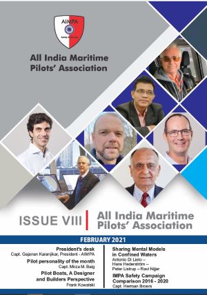
Opinion AIMPA has published "Providing Peek into Marine Pilots' World" - Issue II
published on 21 September 2020
Opinion AIMPA Journal Issue III - October 2020 for download here
by AIMPA - All India Marine Pilots' Association - published on 24 October 2020
Article An Analysis of Pilotage Marine Accidents in Korea (2019)
published on 18 August 2020
Video IMPA receives the 2022 SAFETY4SEA Initiative Award
by SAFETY4SEA - published on 20 October 2022
International Maritime Pilots' Association (IMPA) received the 2022 SAFETY4SEA Initiative Award for conducting annually its ‘Pilot Ladder Safety Campaign’ with the objective of reporting pilots’ experiences of ladders and boarding equipment to the IMO and the wider shipping community. Other distinguished short-listed nominees of this category were: Inmarsat, International Marine Contractors Association (IMCA), Safetytech Accelerator and Seafarers Hospital Society. We are honored to be...
Video HMM - Maiden voyage of HMM Algeciras #7-Rotterdam-arrival
published on 23 June 2020
Video AIS Track CMA CGM MISSOURI grounding in Suez Canal on Oct. 14 2020
published on 16 October 2020
Container ship CMA CGM MISSOURI ran aground in Suez Canal while transiting in southern direction, at around 0930 UTC Oct 14. As of 1745 UTC, probably refloated or moved, several Suez Canal tugs attending. Traffic probably suspended, but it’s not confirmed. No information on what caused grounding.
Container ship CMA CGM MISSOURI, IMO 9679919, dwt 115600, capacity 9448 TEU, built 2016, flag Liberia.
Thanks to Marine Traffic and Nolan Dragon.
Article Change in Brisbane: Poseidon Sea Pilots wins tender
published on 10 February 2021
Video Trinity House Deep Sea Pilots
published on 19 December 2024
Video Sustainability in pilot and embarking ladders - PTR Holland (c)
published on 5 November 2020
Sustainability concerns us all. PTR Holland (c), as a leading manufacturer of pilot and embarking ladders, is committed not only to produce the safest ladders, but also to protect our planet earth through sustainable production. PTR does so by sourcing the timber for the production of the ladders exclusively in accordance with the Federal Stewardship Council (FSC). Look for the FSC logo when buying your ladder. Take responsibility and protect our valuable rainforest! PTR Holland - Often...
