Article

Information & Rules of conduct for maritime pilots regarding COVID-19


by Marine-Pilots.com - published on 19 March 2020 583 -

graphic by WHO (www.WHO.int)

The virus: SARS-CoV-2
SARS-CoV-2 (Sars-CoV-2, severe acute respiratory syndrome coronavirus 2), formerly 2019-nCoV, 2019-novel Corona virus, novel Coronavirus 2019 and Wuhan Coronavirus.
This is the trigger.

The disease: COVID-19
The virus causes the disease called COVID-19 (for coronavirus disease 2019) and is the trigger of the COVID-19 pandemic, which was classified by the WHO as a "health emergency of international concern" on 30 January 2020 and as a pandemic on 11 March 2020. In public, the virus is usually (after the virus family) referred to as novel coronavirus, new coronavirus, coronavirus, corona only or occasionally (after the disease) as covid-19 virus.

Symptoms of COVID-19
- fever
- cough
- difficult breathing


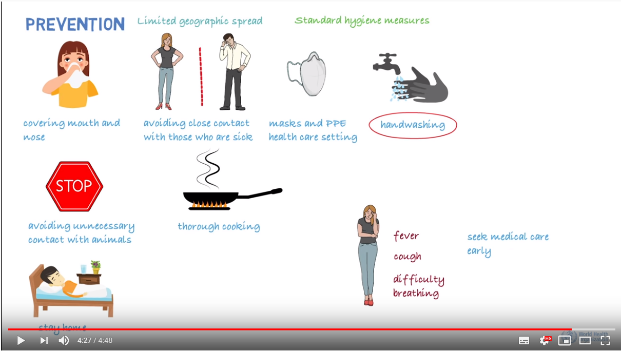
Watch video from the WHO about the virus

Rules of conduct for maritime pilots regarding COVID-19:

Source: post of Christopher Robin on Facebook

Information by the Australian Government about Corona
What's your opinion on this?
Login or register to write comments and join the discussion!
Read more...

Article Information for Marine Pilots about novel coronavirus by Australian Government

by Marine-Pilots.com - published on 10 February 2020

An information sheet for marine pilots about novel coronavirus. Published by the Australian Government - Department of Health

0

Article Coronavirus (COVID-19) guidance for shipping industry by ICS

by Marine-Pilots.com - published on 9 March 2020

Thursday 5th March – The International Chamber of Shipping (ICS) has issued brand new guidance for the global shipping industry to help combat the spread of the Coronavirus (COVID-19). The comprehensive 22-page document has been produced in collaboration with prominent international bodies.

0

Article Current status of the next upcoming Maritime Pilots' events

by Marine-Pilots.com - published on 23 March 2020

What events and meetings for Maritime Pilots are scheduled? Which events are canceled or postponed?
An overview on Marine-Pilots.com:

0

Article The world's largest container ship "Ever Ace" completes its first transit through the Suez Canal

published on 16 October 2021

On August 28, the world's largest container ship completed its first crossing in the Suez Canal. Due to its huge size and this is the first voyage of the ship, it has received extra attention and special treatment from the Suez Canal Authority (SCA).

0

Article Maritime Compliance: USCG Policy – Master Pilot eXchange (MPX) Vs Engine Power Limiter (EPL) and the use of a Shaft Power Limiter (SHaPoLi)

by www.MaritimeCyprus.com - published on 30 May 2024

Article by www.MaritimeCyprus.com: We'd like to bring to your attention the USCG Policy Letter 01-24, which provides “Guidance regarding devices that alter maneuvering characteristics of ships to ensure safe operation in waters of the United States”.

1

Article New app: Pilot´s Tug Assist Tool PTAT - Bollard Pull Calculation for Marine Pilots

by Capt. M. Baykal Yaylai - published on 19 February 2020

Required tug power and number of tugs needed in variable conditions of wind, current and waves isin most cases an assessment made by pilots based on their professional experience. However, assessments will raise questions by lawyers if something goes wrong. They will use tools to calculate what really is needed with respect to tug power and number of tugs. They have furthermore the advantage of time.

2

Article Innovez One to digitalise towage and pilotage operations for the Port of Banten

by Innovez One - published on 9 October 2020

The Port of Banten is an exciting addition to Innovez One’s global roster of ports. It is the 4th port in Indonesia alone to adopt marineM, Innovez One’s cutting-edge digital solution to optimise its towage and pilotage operations.

0

Opinion Titans: Google Maps versus ECDIS

by Melvin Mathews - published on 3 November 2020

Google Maps and ECDIS (Electronic Chart Display and Information System) can be considered to essentially serve the same purpose. While Google Maps is used for finding our way on land, the ECDIS facilitates navigation at sea.

1