Graphic by Capt. Pascal Rhéaume, CLSLP
Press release from November 5, 2019 by Maritime Simulation and Resource Centre (MSRC), Canada
WSP, CLSLP, MSRC AND SAKHALIN ARE AWARDED A CONTRACT TO IMPLEMENT NEW BATHYMETRY, SURFACE CURRENT AND TIDAL STANDARDS
WSP, one of the world’s largest professional engineering consulting firms, in partnership with maritime navigation software provider Sakhalin, the Corporation of Lower Saint Lawrence Pilots Inc. (CLSLP), and the Maritime Simulation and Resource Centre (MSRC), announced that it has entered into a contract to provide pilots and the maritime industry with more accurate data for maritime navigation in Canada.
With this mandate, the Canadian Hydrographic Service (CHS) wishes to promote the implementation of the new S-100 standards to provide mariners with access to additional information (bathymetry, surface currents and water levels) and greater versatility in the display of these data.
Graphic by Capt. Pascal Rhéaume, CLSLP
The WSP’s Geospatial and Business Solutions team will manage the project on behalf of all the partners. “WSP was able to demonstrate its ability to innovate by working in collaboration with various partners to provide an innovative and turnkey solution. Our client-focused approach and an integrated services offering have really made a difference,” said Olivier Joyal, Business Line Executive, Environment.
Sakhalin, developer of the SEAiq Pilot application, will modify its existing navigation software to load and display data from the new S-100 standards, in accordance with the International Hydrographic Organization (IHO) norms and standards used by CHS.
Thanks to its team of experienced pilots, the CLSLP will offer its expertise to validate and test the various standards on the SEAiq Pilot software. They will ensure that the deployment of S-100 standards meets the needs and operational realities of pilots. They will also participate in the development of the various functionalities that will be created or modified in order to benefit from the new standards’ advantages.
The MSRC, a division of the CLSLP, will provide the navigation simulation bridges and the expertise necessary to visualize the effects of using S-100 standards. Their experience in testing various navigation software will be used to validate and document the deliverables expected by customers.
WSP, CLSLP, MSRC and Sakhalin are awarded a contract to implement new bathymetry, surface current and tidal standards.
Editors Note:
With the advent of electronic navigation and the technological progress of surveying systems and production capabilities, the ability to enhance maritime navigation with the portrayal of high resolution bathymetry has become a requirement. The provision and utilization of such data in a standardized format is essential to support the safe and precise navigation of marine vessels, and furthermore an important basis for many other maritime applications.
More Articles and Video about S-102 below...
Chart Standards:
S-101 Electronic Navigational Chart (ENC)
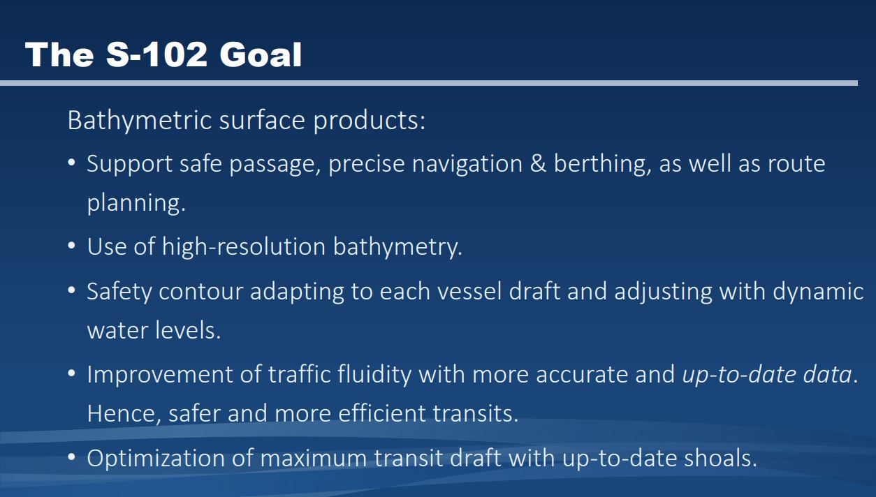
S-102 Bathymetric Surface
S-104 Water Level Information for Surface Navigation
S-111 Surface Currents
S-121 Maritime Limits and Boundaries
S-122 Marine Protected Areas (MPAs)
S-123 Marine Radio Services
S-124 Navigational Warnings
S-125 Marine Navigational Services
S-126 Marine Physical Environment
S-127 Marine Traffic Management
S-128 Catalogue of Nautical Products
S-129 Under Keel Clearance Management (UKCM)
S-201 Aids to Navigation Information
S-211 Port Call Message Format
S-240 DGNSS Station Almanac
S-401 Inland ENC
S-402 Bathymetric Contour Overlay for Inland ENC
S-411 Sea Ice Information
S-412 Weather Overlay
Press release from November 5, 2019 by Maritime Simulation and Resource Centre (MSRC), Canada
WSP, CLSLP, MSRC AND SAKHALIN ARE AWARDED A CONTRACT TO IMPLEMENT NEW BATHYMETRY, SURFACE CURRENT AND TIDAL STANDARDS
WSP, one of the world’s largest professional engineering consulting firms, in partnership with maritime navigation software provider Sakhalin, the Corporation of Lower Saint Lawrence Pilots Inc. (CLSLP), and the Maritime Simulation and Resource Centre (MSRC), announced that it has entered into a contract to provide pilots and the maritime industry with more accurate data for maritime navigation in Canada.
With this mandate, the Canadian Hydrographic Service (CHS) wishes to promote the implementation of the new S-100 standards to provide mariners with access to additional information (bathymetry, surface currents and water levels) and greater versatility in the display of these data.
Graphic by Capt. Pascal Rhéaume, CLSLP
The WSP’s Geospatial and Business Solutions team will manage the project on behalf of all the partners. “WSP was able to demonstrate its ability to innovate by working in collaboration with various partners to provide an innovative and turnkey solution. Our client-focused approach and an integrated services offering have really made a difference,” said Olivier Joyal, Business Line Executive, Environment.
Sakhalin, developer of the SEAiq Pilot application, will modify its existing navigation software to load and display data from the new S-100 standards, in accordance with the International Hydrographic Organization (IHO) norms and standards used by CHS.
Thanks to its team of experienced pilots, the CLSLP will offer its expertise to validate and test the various standards on the SEAiq Pilot software. They will ensure that the deployment of S-100 standards meets the needs and operational realities of pilots. They will also participate in the development of the various functionalities that will be created or modified in order to benefit from the new standards’ advantages.
The MSRC, a division of the CLSLP, will provide the navigation simulation bridges and the expertise necessary to visualize the effects of using S-100 standards. Their experience in testing various navigation software will be used to validate and document the deliverables expected by customers.
WSP, CLSLP, MSRC and Sakhalin are awarded a contract to implement new bathymetry, surface current and tidal standards.
Editors Note:
With the advent of electronic navigation and the technological progress of surveying systems and production capabilities, the ability to enhance maritime navigation with the portrayal of high resolution bathymetry has become a requirement. The provision and utilization of such data in a standardized format is essential to support the safe and precise navigation of marine vessels, and furthermore an important basis for many other maritime applications.
More Articles and Video about S-102 below...
Chart Standards:
S-101 Electronic Navigational Chart (ENC)
S-102 Bathymetric Surface
S-104 Water Level Information for Surface Navigation
S-111 Surface Currents
S-121 Maritime Limits and Boundaries
S-122 Marine Protected Areas (MPAs)
S-123 Marine Radio Services
S-124 Navigational Warnings
S-125 Marine Navigational Services
S-126 Marine Physical Environment
S-127 Marine Traffic Management
S-128 Catalogue of Nautical Products
S-129 Under Keel Clearance Management (UKCM)
S-201 Aids to Navigation Information
S-211 Port Call Message Format
S-240 DGNSS Station Almanac
S-401 Inland ENC
S-402 Bathymetric Contour Overlay for Inland ENC
S-411 Sea Ice Information
S-412 Weather Overlay

